
Service 05
Drone / Aerial Site Capture
Roofs, sites and conditions you cannot reach from the ground.
Aerial capture documents the parts of a property that interior scanning cannot see: the roof field, the site boundary, parking, drainage, grading and the conditions along a facade that a ladder and a clipboard never fairly record.
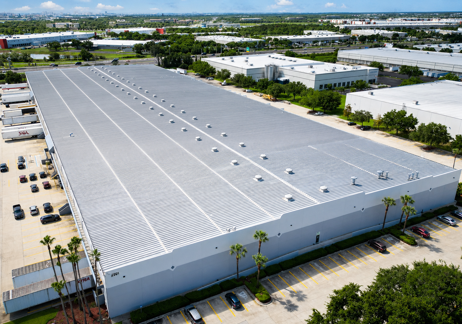
We fly the site on a planned grid, so the resulting imagery and model are measured and repeatable rather than a handful of pretty photos. That means the same site can be flown again at a later date and compared against the first flight.
For large campuses, retail centers and industrial sites, aerial capture is usually paired with interior scanning — one crew, one coordinate system, one deliverable set covering the whole property.
Where it gets used
Common uses
Roof condition surveys
Identify ponding, damaged membrane, flashing failures and penetrations without putting a person on the roof.
Site and drainage review
See grading, water paths and standing water across the whole parcel at once.
Campus and multi-building planning
Document an entire property, including the spaces between buildings, in a single model.
Construction progress
Fly the site at milestones for a visual record that matches the schedule.
Solar and equipment layout
Measure roof area, orientation and obstructions to size and place a system.
Parking, paving and landscape
Quantify pavement, striping, curbs and landscaping for budgeting and bids.
Deliverables
What you receive
Everything below ships as one package — no separate line item for the walkthrough.
- Orthomosaic map of the site, scaled and georeferenced
- Aerial point cloud and 3D site model
- Roof plan with areas, slopes and penetrations
- Contour and topographic surface where the project needs one
- Geotagged aerial photograph set
- Repeat flights for progress or condition comparison
Why teams choose us for this
What makes the difference
Airspace handled
We coordinate the site permissions and airspace authorization the location needs before we arrive.
Measured, not just photographed
Flights are planned on a grid so outputs are scaled and repeatable.
One crew, inside and out
Aerial and interior capture come from the same team, so the deliverables line up.
Safer than the alternative
Roofs, steep grades and tall facades get documented without putting your people at height.
How it works
From site to deliverable
- 01
Scope
We check the site location, the airspace it sits in, and what the roof or site needs to show.
- 02
Fly
The crew flies a planned grid at the altitude the resolution requires, with a ground control check where needed.
- 03
Process
Imagery is turned into an orthomosaic, a point cloud and a model, then checked against the site.
- 04
Deliver
You receive the maps, model and photo set — plus a repeat flight option for later comparison.
Questions
Drone / Aerial Site Capture, answered.
Can you fly in a city?+
Yes, with the right authorization. Urban and controlled airspace needs coordination first, and we handle that before the flight date.
What stops a flight?+
Rain, heavy wind, low cloud and restricted airspace. We reschedule rather than fly a bad day, because a bad day produces unusable data.
How detailed is the output?+
Resolution is set by flight altitude and camera. We choose the altitude the deliverable needs — a roof condition review flies lower than a whole-campus overview.
Does aerial capture include interiors?+
No, but it pairs with interior scanning. Many projects are quoted as one package so the site model and the building model line up.
Can you compare two dates?+
Yes. A repeat flight over the same site gives a before-and-after record for progress, damage or warranty claims.
By building type
Where we do this work
Other services
Also worth a look
Ready to capture your site?
Free consultation and quote — usually within one business day.